Choosing the right map for your adventure is important for staying safe on the trail and adhering to the regulations set for that area or activity. Consider this list of resources next time you head out and remember to always check with the Forest Service if you are unsure of regulations or boundaries.
Sawtooth National Recreation Area Maps
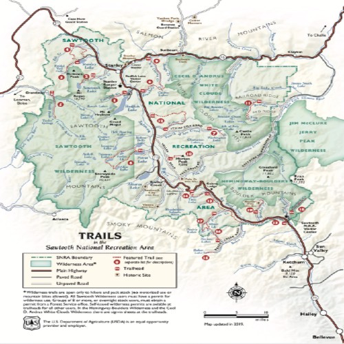

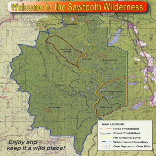
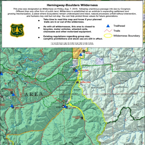
Wilderness Maps
SAWTOOTH WILDERNESS
Located on the Western Side of the SNRA, the Sawtooth Wilderness extends from Redfish Lake on the East side to Grandjean on the West Side.
HEMINGWAY-BOULDERS
Located on the Southeast side of the SNRA, the Hemingway-Boulders extend from the SNRA Headquarters on the South side, to Galena, and to the Headwaters of the East Fork of the Salmon River.
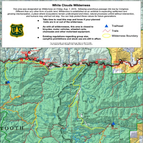
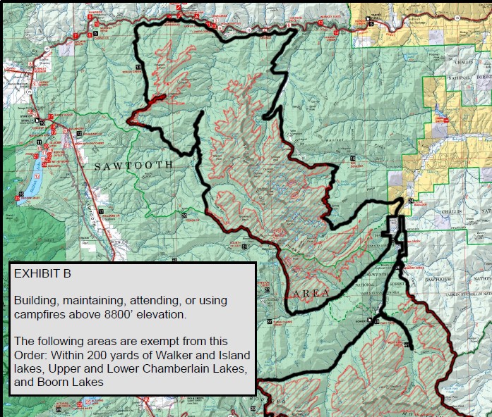
WHITE CLOUDS AND HEMINGWAY FIRE RESTRICTIONS
Fires are strictly forbidden above 8,800 feet in both Wilderness areas, with a few exceptions around certain alpine lakes.